Search, Browse, and Discover
A new digital interactive map makes engaging with the beautiful Scott Arboretum easier.
"It is amazing to have such a wealth of information about our plant collections and the campus landscape readily accessible using a smartphone,” says Claire Sawyers, director of the Scott Arboretum.
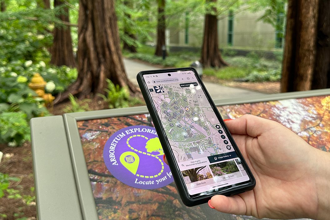
A new digital interactive map will help visitors and the College community learn about the more than 4,000 plant varieties and 425 acres of cultivated, flowering hills on campus. The Scott Arboretum Explorer helps users search and navigate the arboretum’s plant collection and beautiful campus.
"We are particularly pleased that we now have the Arboretum collections on maps that are synchronized with the College's facilities maps,” says Claire Sawyers, director of the Scott Arboretum. “This is a huge step forward, in coordinating work and protecting trees, particularly now with the multitude of college construction projects underway."
The volume of plants, frequency of plant updates, and educational purposes of the Arboretum mean that a robust plant-record management system and a publicly accessible application for exploration are integral to support Scott Arboretum’s ongoing mission. The new Arboretum Explorer application, developed in the latest version of the ArcGIS Maps SDK for JavaScript, is an interactive site for researchers, staff, and visitors to explore both Arboretum and campus attractions and filter and search for plants and memorials. The interactive map enhances the user experience of engaging with the botanical database, enabling Scott Arboretum to more effectually operate and present information to users.
"It is amazing to have such a wealth of information about our plant collections and the campus landscape readily accessible using a smartphone,” says Sawyers. “This is fundamental to the Scott Arboretum living up to its mission."
In 2021, Blue Raster partnered with the Scott Arboretum to establish a synchronization process between GIS and the Arboretum’s botanical repository, BG-BASE, as well as update and modernize Arboretum Explorer, the Arboretum’s public site. Blue Raster created GIS data representing surveyed plant locations, garden features, points of interest, and other reference data for visitor amenities visualized in Arboretum Explorer.
The team also facilitated the expansion of field GIS for plant mapping, leveraging ArcGIS Field Maps to streamline and improve efficiency of data collection and updates. The workflow allows the curator to modify and update plant records in the field while edits are committed in near real-time, flowing seamlessly into internal and public applications.
The Arboretum hosts numerous learning programs and volunteers, and supports education at the College. One of its central goals is to cultivate and display plants specific to the region to inspire visitors with ideas for their own gardens. Arboretum Explorer is dynamic, highlighting the Arboretum’s garden collections, allowing users to identify dedicated benches and plaques, and features other tools for navigating the historic gardens.
“I'm grateful to all our donors who helped make this significant accomplishment possible with their financial support over the past two years,” says Sawyers. “We are also grateful to the Stanley Smith Horticultural Trust Fund, which provided financial support for funding the 'search and browse' capability of the program.”
Discover the Map here: https://arboretumexplorer.scottarboretum.org/arboretumexplorer/